|
|
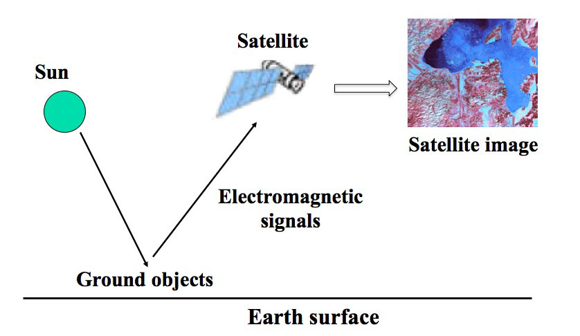
Analysis of remote sensing images
Remote sensing is a field that uses arial or satellite technology to study objects on the Earth, usually through the
electromagnetic radiation signals emitted from the objects. Such signals are recorded as remote sensing images.
Remote sensing has emerged as the most efficient approach to monitor land cover and its changes in time over a variety of spatial scales. In recent years, remote sensing has been
playing increasingly more important roles in some large scale studies, such as weather forecasts, wetland monitoring, climate change
(26 out of the 50 essential climate variables derived from satellite data according to the Global Climate Observing System (GCOS)), and natural disasters (floods, droughts, landslides) etc.
Our work focus on the applications and methodological development of remote sensing images, as well as theoretical understanding of various phenomena arising in remote sensing.
|
|
Citation
[1] L. Yu, L. Liang, J. Wang, Y. Zhao, Q. Cheng, L. Hu, S. Liu, L. Yu, X. Wang, P. Zhu, X. Li, Y. Xu, C. Li, W. Fu, X. Li, W. Li, C. Liu, N. Cong, H. Zhang, F. Sun, X. Bi, Q. Xin, D. Li, D. Yan, Z. Zhu, M. F. Goodchild, P. Gong.
Meta-discoveries from a synthesis of satellite-based land-cover mapping research.
International Journal of Remote Sensing, Vol 35(13), 4573-4588, 2014.
[2] D. Yan, C. Li, N. Cong, L. Yu and P. Gong.
A structured approach for the analysis of remote sensing images.
International Journal of Remote Sensing, Vol 40(20), 7874-7897, 2019.
arXiv:1901.09317
[3] D. Yan, P. Gong, A. Chen and L. Zhong.
On the statistical nature of remote sensing image mis-registration and classification under data contamination, 2018 (submitted).
[4] D. Yan, P. J. Bickel and P. Gong.
A bottom-up approach to texture modeling with applications to Ikonos image classification, 2018.